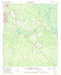
1970 Map of Jesup East
USGS Topo · Published 1988About this map
The Altamaha River defines the northeastern boundary of this landscape, where the Old River channel and Kentucky Island Swamp create a complex network of wetlands and sloughs. Settled areas like Gardi and Odessa are positioned along the Southern railroad line, illustrating the importance of rail transport for these rural communities. To the northwest, the city of Jesup shows signs of expansion, with its urban footprint reaching toward the Little McMillon Creek drainage system.
Find a feature on this map
37 named features on this map. Tap any name to fly to it.
Don’t see what you’re looking for? This feature index may not catch every label — zoom into the map to look around manually.
Map Details
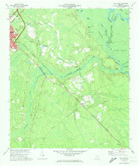
Editions of this 1970 Jesup East Map
2 editions found
Other maps of this area

1918 · Jesup
USGS Topo · 1:62,500

1918 · Hortense
USGS Topo · 1:62,500

1918 · Everett City
USGS Topo · 1:62,500

1920 · Everett City
USGS Topo · 1:62,500

1943 · Ludowici
USGS Topo · 1:62,500

1943 · Jesup
USGS Topo · 1:62,500

1944 · Everett City
USGS Topo · 1:62,500

1944 · Hortense
USGS Topo · 1:62,500

1946 · Brunswick
USGS Topo · 1:250,000

1948 · Brunswick
USGS Topo · 1:250,000