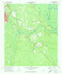
1970 Map of Jesup East
USGS Topo · Published 1974About this map
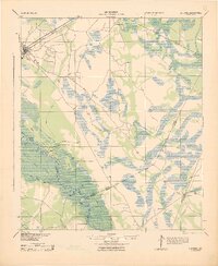
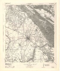
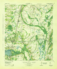
The city of Jesup serves as a major rail hub in the early 1970s, where the Seaboard Coast Line and Southern railroads intersect. This southeastern Georgia landscape is defined by the heavy wetlands of the Altamaha River and the Old River Swamp, which isolate prominent landforms like Boyles Island. The map documents a rural river economy transitioning toward modern utility, evidenced by the numerous landings such as Mac Fishery Landing and Plank Landing contrasted against a cross-country Pipeline. Moving southeast from the city, the rail corridor passes through small communities and local landmarks including Odessa, Gardi, and several rural sanctuaries such as Smith Grove Ch and Midway Ch. The presence of numerous named lakes and sloughs, like Gardner Lake and Little Diana Slough, reflects the complex hydrology of the Wayne County backcountry.
Find a feature on this map
40 named features on this map. Tap any name to fly to it.
Don’t see what you’re looking for? This feature index may not catch every label — zoom into the map to look around manually.
Map Details
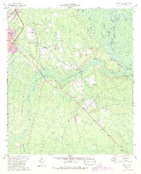
Editions of this 1970 Jesup East Map
2 editions found
Other maps of this area
1918 · Jesup
USGS Topo · 1:62,500
1918 · Hortense
USGS Topo · 1:62,500

1918 · Everett City
USGS Topo · 1:62,500

1920 · Everett City
USGS Topo · 1:62,500
1943 · Ludowici
USGS Topo · 1:62,500
1943 · Jesup
USGS Topo · 1:62,500

1944 · Everett City
USGS Topo · 1:62,500
1944 · Hortense
USGS Topo · 1:62,500

1946 · Brunswick
USGS Topo · 1:250,000

1948 · Brunswick
USGS Topo · 1:250,000