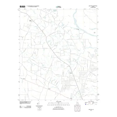
2011 Map of Jesup NW
USGS Topo · Published 2011About this map
Oglethorpe Bluff overlooks a sharp bend in the Altamaha River as it winds toward the Atlantic, anchoring this portion of Wayne County. The landscape is defined by an intricate network of waterways, including Little Goose Creek and Goose Creek, which drain the low-lying terrain north of Jesup. This 2011 survey shows a mix of rural settlements and modern residential expansion, with established areas like Madray Springs and Redland connected by an evolving road system. Evidence of the region’s agricultural roots persists in names like Chapman Plantation Rd, while the Pinecrest Memorial Cemetery serves as a central landmark for local genealogy. The map also detail shoreline features such as Carter Island and the isolated oxbow known as Hughes Old River, illustrating the natural shifts of the coastal plain river system over time.
Find a feature on this map
93 named features on this map. Tap any name to fly to it.
Don’t see what you’re looking for? This feature index may not catch every label — zoom into the map to look around manually.
Map Details
Editions of this 2011 Jesup NW Map
This is the sole edition of this map. No revisions or reprints were ever made.
Other maps of this area

1918 · Jesup
USGS Topo · 1:62,500

1920 · Glennville
USGS Topo · 1:62,500

1943 · Jesup
USGS Topo · 1:62,500

1944 · Glennville
USGS Topo · 1:62,500

1946 · Brunswick
USGS Topo · 1:250,000

1948 · Brunswick
USGS Topo · 1:250,000

1950 · Glennville
USGS Topo · 1:62,500

1953 · Waycross
USGS Topo · 1:250,000

1956 · Brunswick
USGS Topo · 1:250,000

1958 · Waycross
USGS Topo · 1:250,000