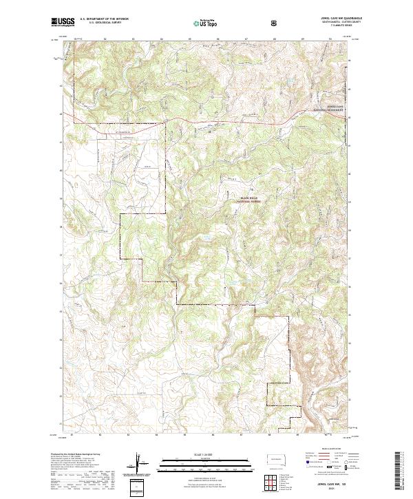
2021 Map of Jewel Cave NW
USGS Topo · Published 2021About this map
Sallee Ranch sits at the heart of this landscape, where the high plains meet the intricate drainage systems of the western Black Hills. This area, managed largely as part of the Black Hills National Forest, is defined by a dense network of deep draws and canyons, including Gillette Canyon, Hell Canyon, and Tepee Canyon. The northwestern portion of Jewel Cave National Monument is visible on the eastern edge, highlighting the region's geological significance. Local infrastructure is concentrated around residential developments like Custer Highland Rd, while numerous remote water sources such as Jumpoff Spring, Baldwin Spring, and Sawmill Spring dot the backcountry. The map also records unique local landmarks like the White Stake and topographic features such as Phone Line Ridge, reflecting the practical naming conventions of ranching and forestry management.
Find a feature on this map
70 named features on this map. Tap any name to fly to it.
Don’t see what you’re looking for? This feature index may not catch every label — zoom into the map to look around manually.
Map Details
Editions of this 2021 Jewel Cave NW Map
This is the sole edition of this map. No revisions or reprints were ever made.
Other maps of this area

1896 · Harney Peak
USGS Topo · 1:125,000

1899 · Newcastle
USGS Topo · 1:125,000

1901 · Harney Peak
USGS Topo · 1:125,000

1901 · Newcastle
USGS Topo · 1:125,000

1951 · Dewey
USGS Topo · 1:24,000

1951 · Fanny Peak
USGS Topo · 1:24,000

1951 · Clifton
USGS Topo · 1:24,000

1954 · Jewel Cave SE
USGS Topo · 1:24,000
1954 · Jewel Cave SW
USGS Topo · 1:24,000

1955 · Dead Horse Flats
USGS Topo · 1:24,000