
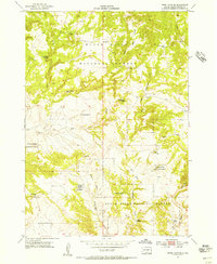
1954 Map of Jewel Cave SE
USGS Topo · Published 1956About this map
Black Hills National Forest land dominates this mid-century landscape in Custer County, revealing a terrain defined by its water sources and drainage patterns. The map highlights several named water features essential for life in this arid environment, including Issue Wood Spring, Rogers Shack Spring, and Pine Tree Spring. The presence of the McClelland Sch in the southwestern portion suggests the presence of a rural community that relied on these scattered resources. The topography is intricately carved by the East Fork Hawkwright Creek and the West Fork, which converge as they move through the hills toward Red Canyon. This survey, conducted in conjunction with the United States Atomic Energy Commission, provides a detailed view of the natural landmarks and early 20th-century development before modern infrastructure reached this part of South Dakota.
Find a feature on this map
17 named features on this map. Tap any name to fly to it.
Don’t see what you’re looking for? This feature index may not catch every label — zoom into the map to look around manually.
Map Details
Editions of this 1954 Jewel Cave SE Map
4 editions found
Other maps of this area

1896 · Harney Peak
USGS Topo · 1:125,000

1901 · Harney Peak
USGS Topo · 1:125,000

1902 · Edgemont
USGS Topo · 1:125,000

1950 · Burdock
USGS Topo · 1:24,000

1950 · Edgemont NE
USGS Topo · 1:24,000

1950 · Minnekahta
USGS Topo · 1:24,000

1954 · Fourmile
USGS Topo · 1:24,000
1954 · Jewel Cave SW
USGS Topo · 1:24,000

1955 · Jewel Cave NW
USGS Topo · 1:24,000

1955 · Jewel Cave
USGS Topo · 1:24,000