
1955 Map of Jewel Cave NW
USGS Topo · Published 1956About this map
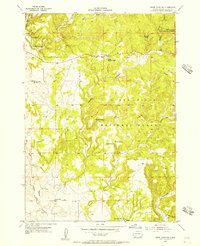
Jewel Cave National Monument and the Black Hills National Forest dominate this mid-century topographic survey of western South Dakota. The landscape is defined by an intricate network of drainage systems, including Hell Canyon, Tepee Canyon, and Schenk Canyon, which carve through the high terrain. Human presence is sparse and tied to ranching and federal land management, evidenced by the X-T Ranch and Soper Ranch, as well as the Tepee Ranger Station. Evidence of shifting rural demographics is preserved in the location of the Lauzon Sch and the Elk Mountain Sch (Abandoned), pointing to a time when small schoolhouses served the families scattered across these remote draws and spring-fed plateaus. Numerous named water sources like Baldwin Spring and Lost Spring highlight the critical importance of water access in this semi-arid region of Custer County.
Find a feature on this map
25 named features on this map. Tap any name to fly to it.
Don’t see what you’re looking for? This feature index may not catch every label — zoom into the map to look around manually.
Map Details
Editions of this 1955 Jewel Cave NW Map
4 editions found
Other maps of this area

1896 · Harney Peak
USGS Topo · 1:125,000

1899 · Newcastle
USGS Topo · 1:125,000

1901 · Harney Peak
USGS Topo · 1:125,000

1901 · Newcastle
USGS Topo · 1:125,000

1951 · Dewey
USGS Topo · 1:24,000

1951 · Fanny Peak
USGS Topo · 1:24,000

1951 · Clifton
USGS Topo · 1:24,000

1954 · Jewel Cave SE
USGS Topo · 1:24,000
1954 · Jewel Cave SW
USGS Topo · 1:24,000

1955 · Dead Horse Flats
USGS Topo · 1:24,000