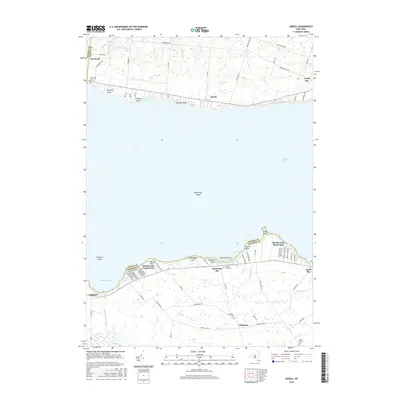
2016 Map of Jewell
USGS Topo · Published 2016About this map
Oneida Lake dominates this central New York landscape, its southern and northern shores defined by distinct clusters of seasonal and year-round settlements. To the north, Jewell and Cleveland sit along the shoreline, where the terrain begins to rise toward Stone Barn Rd and the Hall Brook drainage. The southern shore in Madison County shows a higher density of localized development, including the neighborhoods of Oneida Lake Beach West and Oneida Lake Beach East.
Find a feature on this map
85 named features on this map. Tap any name to fly to it.
Don’t see what you’re looking for? This feature index may not catch every label — zoom into the map to look around manually.
Map Details
Editions of this 2016 Jewell Map
This is the sole edition of this map. No revisions or reprints were ever made.
Other maps of this area

1895 · Chittenango
USGS Topo · 1:62,500

1895 · Oneida
USGS Topo · 1:62,500

1898 · Oneida
USGS Topo · 1:62,500

1898 · Chittenango
USGS Topo · 1:62,500

1902 · Chittenango
USGS Topo · 1:62,500

1902 · Oneida
USGS Topo · 1:62,500

1905 · Taberg
USGS Topo · 1:62,500

1906 · Kasoag
USGS Topo · 1:62,500

1939 · Oneida
USGS Topo · 1:62,500

1941 · Cleveland
USGS Topo · 1:24,000