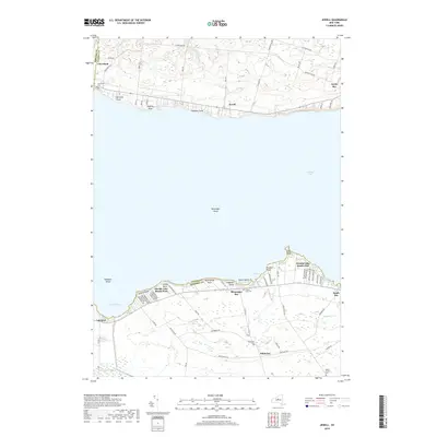
2019 Map of Jewell
USGS Topo · Published 2019About this map
Oneida Lake dominates this 2019 survey, showing the intricate shoreline where Madison, Oneida, and Oswego counties meet. The northern shore is anchored by the historic village of Cleveland, extending east through Jewell toward North Bay. This map details the dense residential development along the southern banks, including the established communities of Oneida Lake Beach West and Oneida Lake Beach East. Small-scale features such as Messenger Shoal and Lakeport Shoal highlight the lake's topography, while inland areas show a transition to agricultural lands near Whitelaw and the winding course of Canaseraga Creek. Genealogists will find several cemeteries noted, including Lakewood Cem, Oneida Lake Cem, and Walker Corners Cem, which provide geographic anchors for family histories in the Town of Sullivan and neighboring townships.
Find a feature on this map
85 named features on this map. Tap any name to fly to it.
Don’t see what you’re looking for? This feature index may not catch every label — zoom into the map to look around manually.
Map Details
Editions of this 2019 Jewell Map
This is the sole edition of this map. No revisions or reprints were ever made.
Other maps of this area

1895 · Chittenango
USGS Topo · 1:62,500

1895 · Oneida
USGS Topo · 1:62,500

1898 · Oneida
USGS Topo · 1:62,500

1898 · Chittenango
USGS Topo · 1:62,500

1902 · Chittenango
USGS Topo · 1:62,500

1902 · Oneida
USGS Topo · 1:62,500

1905 · Taberg
USGS Topo · 1:62,500

1906 · Kasoag
USGS Topo · 1:62,500

1939 · Oneida
USGS Topo · 1:62,500

1941 · Cleveland
USGS Topo · 1:24,000