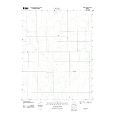
2012 Map of Jewell SE
USGS Topo · Published 2012About this map
Pleasant Prairie Cem stands as a focal point for family history in this portion of Mitchell County, situated amidst the agricultural grid of North Central Kansas. The landscape is defined by the drainage patterns of several seasonal watercourses, most notably Plum Cr, which meanders south through the center of the sheet, joined by Little Cheyenne Cr and W Asher Cr to the east. This 2012 survey illustrates the enduring rural structure of the region, where a precise network of section-line roads like A Rd and Randall Rd dictates the movement across the prairie. The cartography provides a clear look at the intersection of natural hydrology, including Dry Cr, and the human-imposed geometry of the land during the early 21st century.
Find a feature on this map
9 named features on this map. Tap any name to fly to it.
Don’t see what you’re looking for? This feature index may not catch every label — zoom into the map to look around manually.
Map Details
Editions of this 2012 Jewell SE Map
This is the sole edition of this map. No revisions or reprints were ever made.
Other maps of this area

1892 · Concordia
USGS Topo · 1:125,000

1892 · Minneapolis
USGS Topo · 1:125,000

1894 · Mankato
USGS Topo · 1:125,000

1894 · Beloit
USGS Topo · 1:125,000

1953 · Solomon Rapids
USGS Topo · 1:24,000

1953 · Simpson
USGS Topo · 1:24,000

1953 · Beloit
USGS Topo · 1:24,000

1955 · Manhattan
USGS Topo · 1:250,000

1955 · Beloit
USGS Topo · 1:250,000

1956 · Manhattan
USGS Topo · 1:250,000