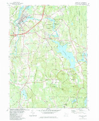
1984 Map of Jewett City
USGS Topo · Published 1984About this map
The Quinebaug River and Pachaug R define the industrial and recreational heart of this eastern Connecticut landscape. In the northwest, Jewett City serves as a dense hub of settlement where the Providence and Worcester railroad corridor meets the river's edge. This 1984 survey highlights the region's transition from historical mill hamlets to modern utility, showing numerous Sand and Gravel Pits and the expansion of the Pachaug State Forest.
Find a feature on this map
52 named features on this map. Tap any name to fly to it.
Don’t see what you’re looking for? This feature index may not catch every label — zoom into the map to look around manually.
Map Details
Editions of this 1984 Jewett City Map
3 editions found
Other maps of this area

1889 · Stonington
USGS Topo · 1:62,500

1889 · Moosup
USGS Topo · 1:62,500

1892 · New London
USGS Topo · 1:62,500

1892 · Norwich
USGS Topo · 1:62,500

1893 · Moosup
USGS Topo · 1:62,500

1893 · Stonington
USGS Topo · 1:62,500

1893 · New London
USGS Topo · 1:62,500

1920 · Moosup
USGS Topo · 1:62,500

1921 · New London
USGS Topo · 1:62,500

1921 · Stonington
USGS Topo · 1:62,500