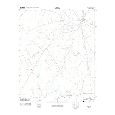
2010 Map of Jewett
USGS Topo · Published 2010About this map
Jewett serves as the primary hub of this Leon County landscape, where the intersection of Broadway Rd and Railroad Ave anchors a community defined by its proximity to agricultural fields and several creeks. The surrounding countryside is dotted with family-named burial grounds including Taylor Cemetery, Peoples Cemetery, and Burleson Cemetery, providing valuable data points for local genealogists. Smaller settlements such as Newby and Concord are linked by a network of farm-to-market roads and county routes that navigate the drainage basins of Birch Creek and Brushy Creek. The terrain is characterized by numerous small ponds and larger water bodies like Rose Lake and Brushy Lake, reflecting the region's ranching and water management history. Aviation is also represented in the local infrastructure through Miles Field and the Morris Lazy K Ranch Airport.
Find a feature on this map
55 named features on this map. Tap any name to fly to it.
Don’t see what you’re looking for? This feature index may not catch every label — zoom into the map to look around manually.
Map Details
Editions of this 2010 Jewett Map
This is the sole edition of this map. No revisions or reprints were ever made.
Other maps of this area

1925 · Marquez No. 1
USGS Topo · 1:48,000

1927 · Marquez
USGS Topo · 1:62,500

1930 · Marquez
USGS Topo · 1:62,500

1954 · Waco
USGS Topo · 1:250,000

1955 · Waco
USGS Topo · 1:250,000

1956 · Jewett
USGS Topo · 1:62,500

1964 · Spring Seat
USGS Topo · 1:24,000

1964 · Margie
USGS Topo · 1:24,000

1965 · Jewett
USGS Topo · 1:24,000
1965 · Robbins
USGS Topo · 1:24,000