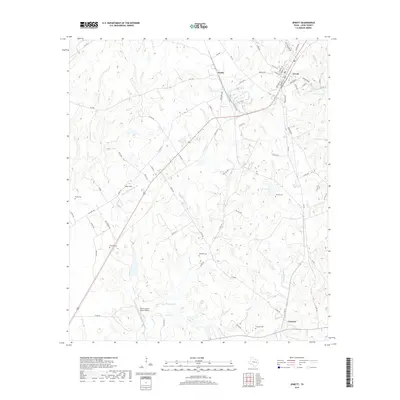
2019 Map of Jewett
USGS Topo · Published 2019About this map
Jewett serves as the primary hub of this Leon County landscape, where the convergence of the Union Pacific rail line and local thoroughfares like FM 39 S and FM 1512 define the local geography. The surrounding countryside is marked by a complex network of tributaries including Brushy Cr and Little Keechi Cr, which drain the rolling terrain between small settlements like Newby and Concord. Genealogists will find significant value in the distribution of family and community burial grounds scattered across the quadrangle, such as Moores Cem, McMillin Cem, and Burleson Cem. Aviation markers also dot the area, including Miles Field and the Morris Lazy K Ranch Airport, reflecting the rural Texas tradition of private airfields integrated into large ranching operations. The presence of Swindler Pond and Brushy Lake further illustrates the importance of water management in this agricultural region.
Find a feature on this map
76 named features on this map. Tap any name to fly to it.
Don’t see what you’re looking for? This feature index may not catch every label — zoom into the map to look around manually.
Map Details
Editions of this 2019 Jewett Map
This is the sole edition of this map. No revisions or reprints were ever made.
Other maps of this area

1925 · Marquez No. 1
USGS Topo · 1:48,000

1927 · Marquez
USGS Topo · 1:62,500

1930 · Marquez
USGS Topo · 1:62,500

1954 · Waco
USGS Topo · 1:250,000

1955 · Waco
USGS Topo · 1:250,000

1956 · Jewett
USGS Topo · 1:62,500

1964 · Spring Seat
USGS Topo · 1:24,000

1964 · Margie
USGS Topo · 1:24,000

1965 · Jewett
USGS Topo · 1:24,000
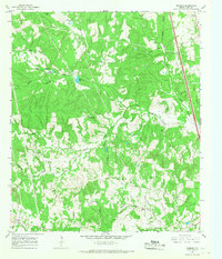
1965 · Robbins
USGS Topo · 1:24,000