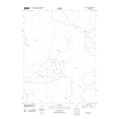
2012 Map of Jewett Rock
USGS Topo · Published 2012About this map
The Eel River winds through this section of the northern California backcountry, defining a landscape of sharp ridges and isolated homesteads. Near the settlement of Kekawaka, the river meets Kekawaka Cr and Queatchumpah Cr beneath the heights of Two Hundred and One Spur. This map documents a series of established ranching properties, including White Ranch, Lauffer Ranch, Wood Ranch, and Marr Ranch, which are connected by a network of winding roads like Island Mountain Rd and Lauffer Rd. Significant vertical landmarks such as Jewett Rock, Walker Butte, and Schroeder Rock dominate the terrain, while Walker Ridge and Mail Ridge offer expansive views over the surrounding Jewett Valley. The presence of specialized routes like Hogtrap Rd and Sesame Street Loop suggests the localized management of these high-elevation pastures and timberlands.
Find a feature on this map
34 named features on this map. Tap any name to fly to it.
Don’t see what you’re looking for? This feature index may not catch every label — zoom into the map to look around manually.
Map Details
Editions of this 2012 Jewett Rock Map
This is the sole edition of this map. No revisions or reprints were ever made.
Other maps of this area

1920 · Cummings
USGS Topo · 1:62,500

1920 · Covelo
USGS Topo · 1:62,500

1920 · Harris
USGS Topo · 1:62,500

1921 · Hoaglin
USGS Topo · 1:62,500

1922 · Island Mountain
USGS Topo · 1:62,500

1931 · Hoaglin
USGS Topo · 1:96,000

1935 · Hoaglin
USGS Topo · 1:125,000

1949 · Alderpoint
USGS Topo · 1:62,500

1951 · Alderpoint
USGS Topo · 1:62,500

1952 · Spyrock
USGS Topo · 1:62,500