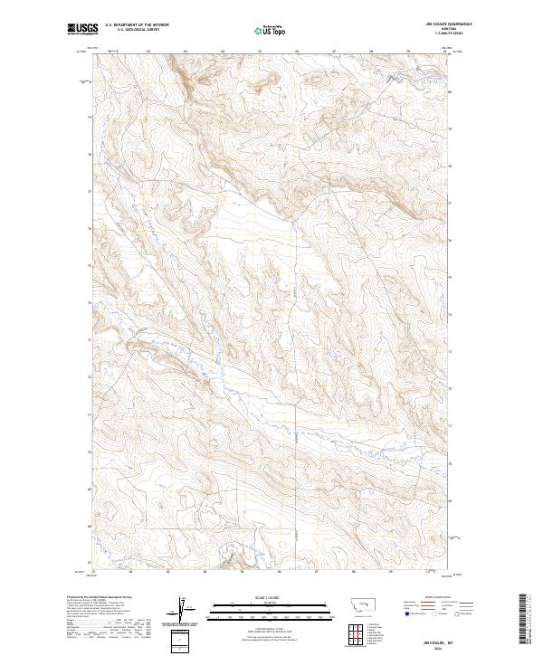
2024 Map of Jim Coulee
USGS Topo · Published 2024About this map
Jim Coulee and its associated drainages define this remote section of the Montana landscape, where the seasonal flow of water has carved deep topographical relief. This modern survey illustrates the sparse settlement patterns typical of central Montana, where the land is primarily organized by the Public Land Survey System as indicated by the grid of t11n r27e and t10n r27e. The map captures the significant elevation changes near the Big Wall landform, a prominent feature rising above the surrounding draws.
Find a feature on this map
12 named features on this map. Tap any name to fly to it.
Don’t see what you’re looking for? This feature index may not catch every label — zoom into the map to look around manually.
Map Details
Editions of this 2024 Jim Coulee Map
This is the sole edition of this map. No revisions or reprints were ever made.
Other maps of this area

1954 · Roundup
USGS Topo · 1:250,000

1958 · Roundup
USGS Topo · 1:250,000

1963 · Kelley
USGS Topo · 1:24,000

1963 · Musselshell NW
USGS Topo · 1:24,000

1963 · Delphia
USGS Topo · 1:24,000

1986 · Flatwillow
USGS Topo · 1:24,000

1986 · Crowley Dam
USGS Topo · 1:24,000

1986 · Big Wall West
USGS Topo · 1:24,000

1986 · Big Wall NW
USGS Topo · 1:24,000
1986 · Big Wall East
USGS Topo · 1:24,000