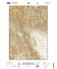
2020 Map of Jimtown
USGS Topo · Published 2020About this map
Pine Valley serves as the focal point for this Baker County landscape, where the small communities of Carson and Jimtown represent the primary centers of settlement. This area is defined by a sophisticated network of historical water management, featuring the Mining Channel, Brooks Ditch, Posy Valley Ditch, and Foothill Ditch, which speak to the region's agricultural and industrial heritage. To the west, the terrain rises into the Whitman National Forest, home to landmarks such as Summit Point and the protected Eagle Creek Wild and Scenic River. The map meticulously details a seasonal infrastructure of winter transit, including the Lodgepole Xc Ski trails and the Eagle Drive Snowmobile route, which navigate the high ground between Summit Creek and Fuller Creek.
Find a feature on this map
63 named features on this map. Tap any name to fly to it.
Don’t see what you’re looking for? This feature index may not catch every label — zoom into the map to look around manually.
Map Details
Editions of this 2020 Jimtown Map
This is the sole edition of this map. No revisions or reprints were ever made.
Other maps of this area

1915 · Pine
USGS Topo · 1:125,000

1954 · Cornucopia
USGS Topo · 1:62,500

1954 · Eagle Cap
USGS Topo · 1:62,500

1955 · Baker
USGS Topo · 1:250,000

1955 · Grangeville
USGS Topo · 1:250,000

1957 · Halfway
USGS Topo · 1:62,500

1957 · Sparta
USGS Topo · 1:62,500

1959 · Baker
USGS Topo · 1:250,000

1959 · Grangeville
USGS Topo · 1:250,000

1981 · Baker
USGS Topo · 1:100,000