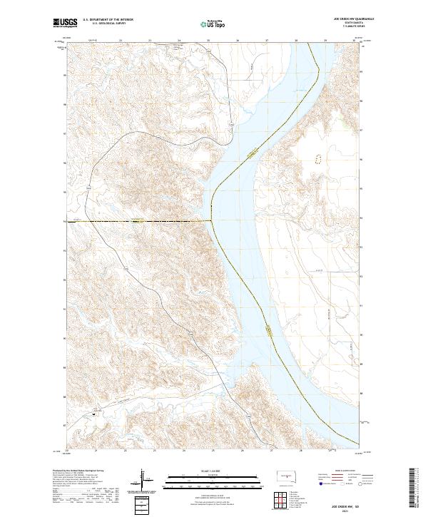
2021 Map of Joe Creek NW
USGS Topo · Published 2021About this map
Lake Sharpe dominates this portion of the Missouri River valley, where the borders of Stanley, Hughes, and Lyman counties converge. The high Missouri plateau is deeply incised by a series of drainages, most notably LaRoche Cr and the successive outlets of First Cr, Second Cr, and Julius Cr. This modern 2021 survey reveals a landscape largely dedicated to ranching and open space, defined by its topographic relief rather than dense settlement.
Find a feature on this map
26 named features on this map. Tap any name to fly to it.
Don’t see what you’re looking for? This feature index may not catch every label — zoom into the map to look around manually.
Map Details
Editions of this 2021 Joe Creek NW Map
This is the sole edition of this map. No revisions or reprints were ever made.
Other maps of this area

1934 · Canning
USGS Topo · 1:48,000

1937 · Canning
USGS Topo · 1:62,500

1953 · Huron
USGS Topo · 1:250,000

1954 · Pierre
USGS Topo · 1:250,000

1954 · Huron
USGS Topo · 1:250,000

1958 · Pierre
USGS Topo · 1:250,000

1966 · Joe Creek
USGS Topo · 1:24,000

1966 · Ft. George Butte SE
USGS Topo · 1:24,000

1966 · Joe Creek NW
USGS Topo · 1:24,000

1966 · Joe Creek SE
USGS Topo · 1:24,000