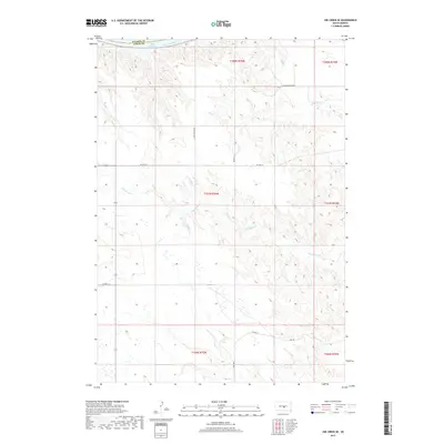
2017 Map of Joe Creek SE
USGS Topo · Published 2017About this map
Lake Sharpe and the Missouri River define the northern boundary of this territory, where the border between Hughes and Lyman counties follows the winding river channel. The landscape south of the water is characterized by the complex drainage network of Bad Horse Cr, which carves through the plains across several townships. This modern survey reflects the contemporary infrastructure of the Big Bend District, highlighting a network of Bureau of Indian Affairs and county routes that provide access to the interior highlands. Local transit is managed through thoroughfares such as BIA Hwy 10, Co Hwy 23, and N Iron Nation Rd, illustrating the intersection of tribal and county land management in this portion of South Dakota.
Find a feature on this map
17 named features on this map. Tap any name to fly to it.
Don’t see what you’re looking for? This feature index may not catch every label — zoom into the map to look around manually.
Map Details
Editions of this 2017 Joe Creek SE Map
This is the sole edition of this map. No revisions or reprints were ever made.
Other maps of this area

1953 · Huron
USGS Topo · 1:250,000

1954 · Huron
USGS Topo · 1:250,000

1955 · Mitchell
USGS Topo · 1:250,000

1959 · Mitchell
USGS Topo · 1:250,000

1966 · Lower Brule NW
USGS Topo · 1:24,000

1966 · Joe Creek
USGS Topo · 1:24,000

1966 · Joe Creek NW
USGS Topo · 1:24,000

1966 · Lower Brule SW
USGS Topo · 1:24,000

1966 · Joe Creek SE
USGS Topo · 1:24,000
1966 · Joe Creek SW
USGS Topo · 1:24,000