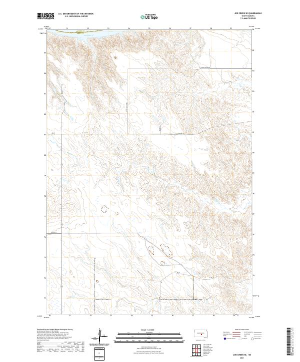
2021 Map of Joe Creek SE
USGS Topo · Published 2021About this map
Lake Sharpe forms the northern boundary of this central South Dakota landscape, marking the winding path of the Missouri River along the border of Hughes and Lyman Counties. The terrain south of the reservoir is defined by the deep, dendritic drainage patterns of Bad Horse Cr, which carves through the high prairie plateaus. This area is characterized by the intersection of tribal and county infrastructure, where routes such as BIA Hwy 10 and N Iron Nation Rd provide access to the remote interior. The map reveals a sparsely settled region dominated by the large-scale township and range divisions of the Public Land Survey System, including t107n r75w and t107n r74w. Local transit is facilitated by a network of rural corridors like Co Hwy 30 and 318th Ave, illustrating the modern management of this Missouri River breaks environment.
Find a feature on this map
16 named features on this map. Tap any name to fly to it.
Don’t see what you’re looking for? This feature index may not catch every label — zoom into the map to look around manually.
Map Details
Editions of this 2021 Joe Creek SE Map
This is the sole edition of this map. No revisions or reprints were ever made.
Other maps of this area

1953 · Huron
USGS Topo · 1:250,000

1954 · Huron
USGS Topo · 1:250,000

1955 · Mitchell
USGS Topo · 1:250,000

1959 · Mitchell
USGS Topo · 1:250,000

1966 · Lower Brule NW
USGS Topo · 1:24,000

1966 · Joe Creek
USGS Topo · 1:24,000

1966 · Joe Creek NW
USGS Topo · 1:24,000

1966 · Lower Brule SW
USGS Topo · 1:24,000

1966 · Joe Creek SE
USGS Topo · 1:24,000
1966 · Joe Creek SW
USGS Topo · 1:24,000