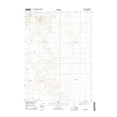
2015 Map of Joe Hay Rim
USGS Topo · Published 2015About this map
Oregon Buttes dominate the high northern landscape of this Sweetwater County quadrangle, marking a prominent navigational landmark in the high desert of southwestern Wyoming. The terrain is defined by the passage of the Continental Divide, which winds through the western half of the sheet, separating the drainages of Bear Cr to the east and the dry washes of Little Bar X Draw to the west. This 2015 data illustrates the sparse, high-altitude infrastructure of the region, where access is limited to gravel routes like Cr-74 and Bar X Rd. The namesake Joe Hay Rim rises in the southwest, overlooking the seasonally dry Mowing Machine Draw. This topography provides a clear view of the water management and ranching access patterns in the Great Divide Basin, where ephemeral streams like Jack Parnell Cr carve through the arid high plains.
Find a feature on this map
13 named features on this map. Tap any name to fly to it.
Don’t see what you’re looking for? This feature index may not catch every label — zoom into the map to look around manually.
Map Details
Editions of this 2015 Joe Hay Rim Map
This is the sole edition of this map. No revisions or reprints were ever made.
Other maps of this area

1955 · Lander
USGS Topo · 1:250,000

1958 · Lander
USGS Topo · 1:250,000

1958 · Pacific Springs
USGS Topo · 1:24,000

1958 · Freighter Gap
USGS Topo · 1:62,500

1958 · The Pinnacles
USGS Topo · 1:62,500

1958 · Dickie Springs
USGS Topo · 1:24,000

1958 · Continental Peak
USGS Topo · 1:24,000

1961 · Lander
USGS Topo · 1:250,000
1984 · South Pass
USGS Topo · 1:100,000
1986 · Joe Hay Rim
USGS Topo · 1:24,000