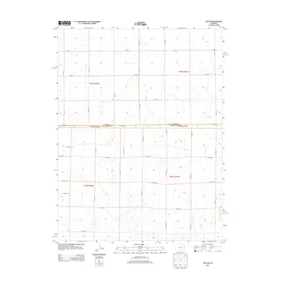
2013 Map of Joes SW
USGS Topo · Published 2013About this map
Hell Cr carves a subtle path through the southeastern corner of this High Plains landscape, representing the primary drainage in an area defined by its vast, open character. The terrain is organized by a rigid grid of agricultural access routes, including Co Road RR and Co Road LL, which delineate the sections of the Public Land Survey System. This 2013 survey illustrates the sparse settlement pattern typical of the region, where the county line between Yuma Co and Kit Carson Co serves as a major administrative boundary. The absence of concentrated town sites emphasizes the area's dedication to large-scale ranching or dryland farming, with only isolated structures and small catchments appearing near labels like Co Road G and Co Road 26.
Find a feature on this map
29 named features on this map. Tap any name to fly to it.
Don’t see what you’re looking for? This feature index may not catch every label — zoom into the map to look around manually.
Map Details
Editions of this 2013 Joes SW Map
This is the sole edition of this map. No revisions or reprints were ever made.
Other maps of this area

1954 · Limon
USGS Topo · 1:250,000

1957 · Limon
USGS Topo · 1:250,000

1958 · Limon
USGS Topo · 1:250,000

1968 · Joes
USGS Topo · 1:24,000

1968 · Adler Creek
USGS Topo · 1:24,000

1969 · Tuttle
USGS Topo · 1:24,000

1969 · Kirk
USGS Topo · 1:24,000

1977 · Cope
USGS Topo · 1:24,000

1977 · Cope SE
USGS Topo · 1:24,000
1978 · Joes SW
USGS Topo · 1:24,000