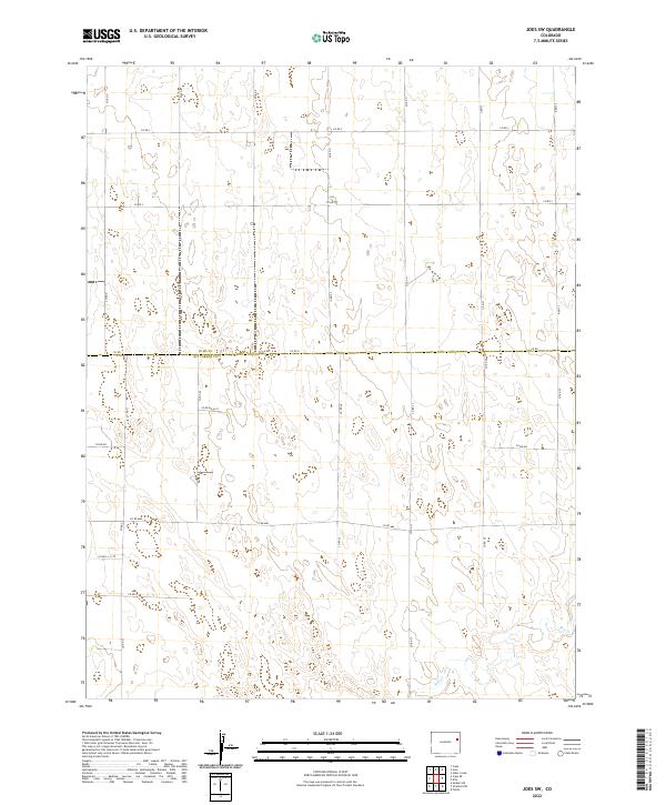
2022 Map of Joes SW
USGS Topo · Published 2022About this map
The county boundary between Yuma Co Kit Carson Co bisects this section of the High Plains, where a geometric grid of rural roads organizes the expansive landscape. The terrain is primarily defined by gentle elevation changes and the presence of Hell Cr in the southeastern corner, one of the few named water features in this high-altitude prairie environment. This 2022 survey illustrates the enduring Public Land Survey System structure, with township lines like t5s r48w and t6s r47w anchoring the legal geography of the region.
Find a feature on this map
30 named features on this map. Tap any name to fly to it.
Don’t see what you’re looking for? This feature index may not catch every label — zoom into the map to look around manually.
Map Details
Editions of this 2022 Joes SW Map
This is the sole edition of this map. No revisions or reprints were ever made.
Other maps of this area

1954 · Limon
USGS Topo · 1:250,000

1957 · Limon
USGS Topo · 1:250,000

1958 · Limon
USGS Topo · 1:250,000

1968 · Joes
USGS Topo · 1:24,000

1968 · Adler Creek
USGS Topo · 1:24,000

1969 · Tuttle
USGS Topo · 1:24,000

1969 · Kirk
USGS Topo · 1:24,000

1977 · Cope
USGS Topo · 1:24,000

1977 · Cope SE
USGS Topo · 1:24,000
1978 · Joes SW
USGS Topo · 1:24,000