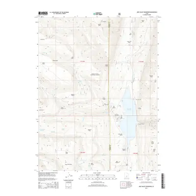
2014 Map of Joes Valley Reservoir
USGS Topo · Published 2014About this map
Joes Valley Reservoir serves as a massive focal point for this mountain landscape on the border of Sanpete and Emery counties. The reservoir and its associated recreation facilities, including Joes Valley Marina and Seely Creek Campground, are surrounded by the high-elevation terrain of the Manti-LaSal National Forest. Higher up the Wasatch Plateau, several smaller catchments like Academy Mill Reservoir and Grass Flat Reservoir illustrate the area's intensive water management system. The map documents the high-country infrastructure of the early 21st century, from the Sportsmans Lodge to the namesake Olsen Canyon and Olsen Ranch. The topography is defined by dramatic elevation changes at The Switchbacks and along Straight Canyon, while landmarks such as Wagon Road Ridge and Water Terrace hint at the historic passage through these western mountains.
Find a feature on this map
60 named features on this map. Tap any name to fly to it.
Don’t see what you’re looking for? This feature index may not catch every label — zoom into the map to look around manually.
Map Details
Editions of this 2014 Joes Valley Reservoir Map
This is the sole edition of this map. No revisions or reprints were ever made.
Other maps of this area

1885 · Manti
USGS Topo · 1:250,000

1895 · Manti
USGS Topo · 1:250,000

1922 · Wasatch
USGS Topo · 1:31,680

1923 · Castle Dale
USGS Topo · 1:62,500

1923 · Hiawatha
USGS Topo · 1:62,500

1925 · Castle Dale
USGS Topo · 1:62,500

1925 · Hiawatha
USGS Topo · 1:62,500

1956 · Price
USGS Topo · 1:250,000

1960 · Price
USGS Topo · 1:250,000

1962 · Price
USGS Topo · 1:250,000