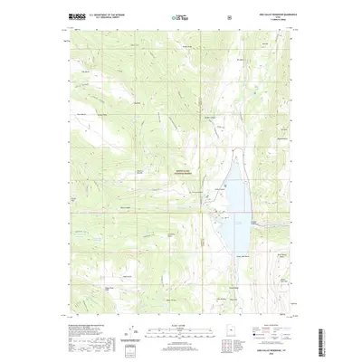
2020 Map of Joes Valley Reservoir
USGS Topo · Published 2020About this map
Joes Valley Reservoir dominates the eastern drainage of the Wasatch Plateau, where the rugged topography of the Manti-La Sal National Forest meets the boundary between Sanpete and Emery Counties. This high-elevation landscape is defined by a complex network of historic routes and water management features, including the Academy Mill Reservoir and Grass Flat Reservoir to the west. The map detail highlights the technical challenges of the terrain, most notably at The Switchbacks where State Hwy 29 climbs toward the plateau.
Find a feature on this map
61 named features on this map. Tap any name to fly to it.
Don’t see what you’re looking for? This feature index may not catch every label — zoom into the map to look around manually.
Map Details
Editions of this 2020 Joes Valley Reservoir Map
This is the sole edition of this map. No revisions or reprints were ever made.
Other maps of this area

1885 · Manti
USGS Topo · 1:250,000

1895 · Manti
USGS Topo · 1:250,000

1922 · Wasatch
USGS Topo · 1:31,680

1923 · Castle Dale
USGS Topo · 1:62,500

1923 · Hiawatha
USGS Topo · 1:62,500

1925 · Castle Dale
USGS Topo · 1:62,500

1925 · Hiawatha
USGS Topo · 1:62,500

1956 · Price
USGS Topo · 1:250,000

1960 · Price
USGS Topo · 1:250,000

1962 · Price
USGS Topo · 1:250,000