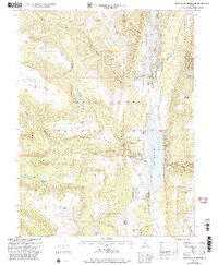
2001 Map of Joes Valley Reservoir
USGS Topo · Published 2004About this map
Joes Valley Reservoir dominates this high-elevation landscape within the Manti-La Sal National Forest, serving as a central water feature at the junction of Lowry Water and Indian Creek. The map documents a rugged topography where massive landforms like Middle Mountain and Wagon Road Ridge define the local drainage patterns. Settlement is sparse, represented primarily by the Orange Olsen Admin Site and the historic Olsen Ranch near Olsen Bench.
Find a feature on this map
58 named features on this map. Tap any name to fly to it.
Don’t see what you’re looking for? This feature index may not catch every label — zoom into the map to look around manually.
Map Details
Editions of this 2001 Joes Valley Reservoir Map
This is the sole edition of this map. No revisions or reprints were ever made.
Other maps of this area

1885 · Manti
USGS Topo · 1:250,000

1895 · Manti
USGS Topo · 1:250,000

1922 · Wasatch
USGS Topo · 1:31,680

1923 · Castle Dale
USGS Topo · 1:62,500

1923 · Hiawatha
USGS Topo · 1:62,500

1925 · Castle Dale
USGS Topo · 1:62,500

1925 · Hiawatha
USGS Topo · 1:62,500

1956 · Price
USGS Topo · 1:250,000

1960 · Price
USGS Topo · 1:250,000

1962 · Price
USGS Topo · 1:250,000