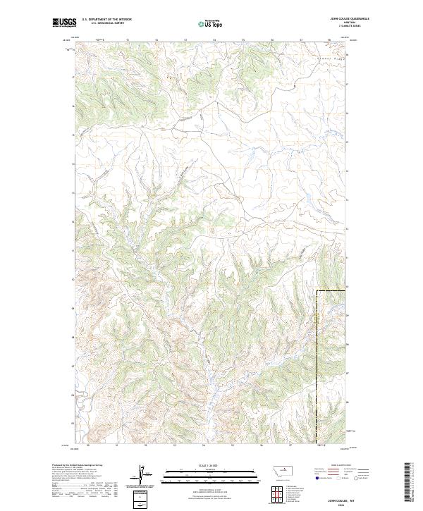
2024 Map of John Coulee
USGS Topo · Published 2024About this map
Upper Missouri River Breaks National Monument defines the southern portion of this landscape, protecting a complex network of coulees and high ridges along the Blaine and Phillips County line. The terrain is characterized by dramatic elevation shifts where Timber Ridge and Spencer Ridge Rd overlook deep drainages. This recent 2024 survey documents the hydrographic patterns of the northern plains, where intermittent watercourses like John Coulee, Buck Coulee, and the curiously named Kills At Night Creek have carved intricate pathways through the earth. Further north, Little Suction Creek and Hay Coulee snake through the sections, while established routes such as Timber Ridge Rd and Hays Rd provide access through this sparsely populated cattle country. The map serves as a precise record of contemporary public land boundaries and the enduring natural features of north-central Montana.
Find a feature on this map
15 named features on this map. Tap any name to fly to it.
Don’t see what you’re looking for? This feature index may not catch every label — zoom into the map to look around manually.
Map Details
Editions of this 2024 John Coulee Map
This is the sole edition of this map. No revisions or reprints were ever made.
Other maps of this area

1943 · Landusky
USGS Topo · 1:125,000

1953 · Havre
USGS Topo · 1:250,000

1954 · Cow Island
USGS Topo · 1:24,000

1954 · Sturgeon Island
USGS Topo · 1:24,000

1954 · Lewistown
USGS Topo · 1:250,000

1956 · Rattlesnake
USGS Topo · 1:62,500

1957 · Havre
USGS Topo · 1:250,000

1958 · Havre
USGS Topo · 1:250,000

1959 · Lewistown
USGS Topo · 1:250,000

1971 · Crazyman Coulee
USGS Topo · 1:24,000