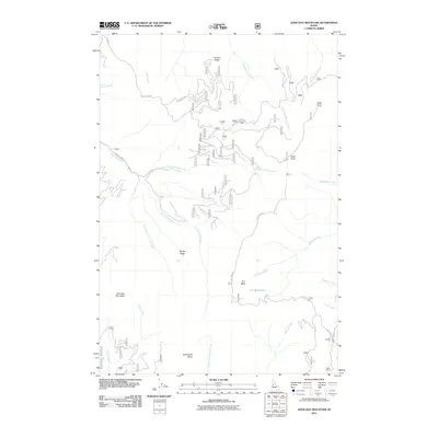
2011 Map of John Day Mountain
USGS Topo · Published 2011About this map
John Day Mountain and the surrounding high country of Idaho County are defined by a complex network of drainage basins and ridges. This modern survey illustrates the rugged water systems feeding into the Salmon River region, including the headwaters of John Day Creek and its major tributaries, the East Fork and South Fork. A high-altitude settlement point at H Rhett sits near the confluence of these waters, while the landscape is further shaped by prominent landmarks like Arrison Ridge and Brushy Ridge.
Find a feature on this map
61 named features on this map. Tap any name to fly to it.
Don’t see what you’re looking for? This feature index may not catch every label — zoom into the map to look around manually.
Map Details
Editions of this 2011 John Day Mountain Map
This is the sole edition of this map. No revisions or reprints were ever made.
Other maps of this area

1938 · Riggins
USGS Topo · 1:96,000

1945 · Riggins
USGS Topo · 1:125,000

1955 · Grangeville
USGS Topo · 1:250,000

1959 · Grangeville
USGS Topo · 1:250,000

1963 · John Day Mtn
USGS Topo · 1:24,000

1963 · Lucile
USGS Topo · 1:24,000

1963 · McKinzie Creek
USGS Topo · 1:24,000

1963 · Slate Creek
USGS Topo · 1:24,000
1963 · Dairy Mountain
USGS Topo · 1:24,000
1963 · Florence
USGS Topo · 1:24,000