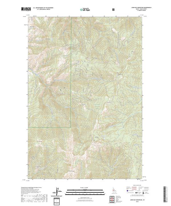
2024 Map of John Day Mountain
USGS Topo · Published 2024About this map
Nez Perce National Forest dominates this Idaho landscape, where the Salmon River drainage is carved by deep gulches and high ridgelines. The terrain is anchored by John Day Mtn and Southwest Butte, with a complex network of waterways including the South Fork John Day Creek and West Fork Allison Creek. This area illustrates the vast, undeveloped character of the Idaho backcountry, marked by land management boundaries like t26n r2e and t25n r3e.
Find a feature on this map
34 named features on this map. Tap any name to fly to it.
Don’t see what you’re looking for? This feature index may not catch every label — zoom into the map to look around manually.
Map Details
Editions of this 2024 John Day Mountain Map
This is the sole edition of this map. No revisions or reprints were ever made.
Other maps of this area

1938 · Riggins
USGS Topo · 1:96,000

1945 · Riggins
USGS Topo · 1:125,000

1955 · Grangeville
USGS Topo · 1:250,000

1959 · Grangeville
USGS Topo · 1:250,000

1963 · John Day Mtn
USGS Topo · 1:24,000

1963 · Lucile
USGS Topo · 1:24,000

1963 · McKinzie Creek
USGS Topo · 1:24,000

1963 · Slate Creek
USGS Topo · 1:24,000
1963 · Dairy Mountain
USGS Topo · 1:24,000
1963 · Florence
USGS Topo · 1:24,000