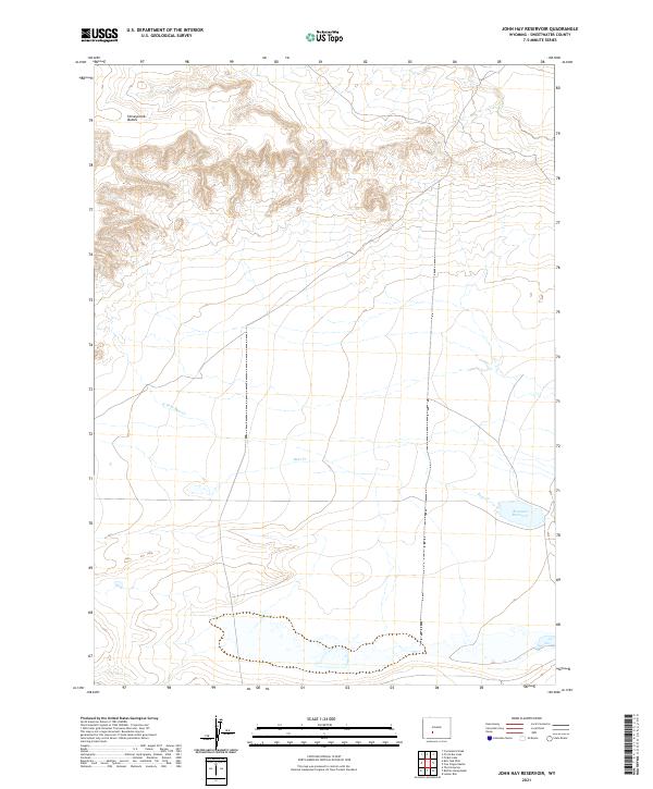
2021 Map of John Hay Reservoir
USGS Topo · Published 2021About this map
Honeycomb Buttes dominate the northern landscape of this region, characterized by intricate contouring that defines the distinct terrain of the Great Divide Basin. The drainage patterns of Bear Cr and its tributary N Fork Bear Cr weave across the central and southern sections, eventually feeding into the Brannan Reservoir in the southeast. This 2021 survey illustrates a sparse, high-desert environment where water management and natural topography are the primary visible features. The grid lines of t26n r99w and surrounding townships mark the systematic division of these public lands, highlighting a landscape primarily defined by its hydrography and geological formations rather than human settlement.
Find a feature on this map
9 named features on this map. Tap any name to fly to it.
Don’t see what you’re looking for? This feature index may not catch every label — zoom into the map to look around manually.
Map Details
Editions of this 2021 John Hay Reservoir Map
This is the sole edition of this map. No revisions or reprints were ever made.
Other maps of this area

1955 · Lander
USGS Topo · 1:250,000

1958 · Lander
USGS Topo · 1:250,000

1958 · Circle Bar Lake
USGS Topo · 1:24,000

1958 · The Pinnacles
USGS Topo · 1:62,500

1958 · Continental Peak
USGS Topo · 1:24,000

1960 · Five Fingers Butte
USGS Topo · 1:62,500

1961 · Lander
USGS Topo · 1:250,000
1961 · Picket Lake
USGS Topo · 1:24,000
1984 · South Pass
USGS Topo · 1:100,000
1986 · Buffalo Hump Basin
USGS Topo · 1:24,000