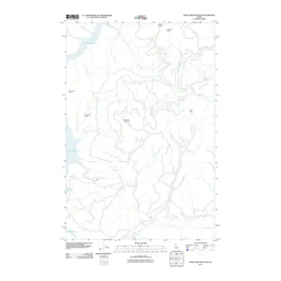
2011 Map of John Lewis Mountain
USGS Topo · Published 2011About this map
John Lewis Mountain rises as a central landmark in this Clearwater County landscape, where the waters of the Dworshak Reservoir fill the deep western canyons. This 2011 survey captures a sparsely settled region defined by its complex drainage systems and significant elevation changes. To the west, Riverview Point overlooks the reservoir's fingers, while the Big Island Airport sits near the confluence of Lewis Creek and Evans Creek, serving as a vital transport link in the backcountry. The map documents numerous named drainages including North Fork Big Creek and South Fork Big Creek, which converge near the locality of Daniels. High-altitude features like Griner Saddle, Lightning Points, and Bear Butte provide a clear view of the ridgelines that divide the Silver Creek and Meadow Creek watersheds.
Find a feature on this map
27 named features on this map. Tap any name to fly to it.
Don’t see what you’re looking for? This feature index may not catch every label — zoom into the map to look around manually.
Map Details
Editions of this 2011 John Lewis Mountain Map
This is the sole edition of this map. No revisions or reprints were ever made.
Other maps of this area

1923 · Washington Creek
USGS Topo · 1:125,000

1936 · Boehls Butte
USGS Topo · 1:48,000

1938 · Headquarters
USGS Topo · 1:48,000

1943 · Boehls Butte
USGS Topo · 1:62,500

1944 · Headquarters
USGS Topo · 1:62,500

1955 · Pullman
USGS Topo · 1:250,000

1956 · Hamilton
USGS Topo · 1:250,000

1958 · Pullman
USGS Topo · 1:250,000

1959 · Hamilton
USGS Topo · 1:250,000

1960 · Hamilton
USGS Topo · 1:250,000