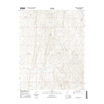
2017 Map of John Mills Lake
USGS Topo · Published 2017About this map
John Mills Lake and Dulce Lake serve as primary water features in this high-altitude landscape of northern Rio Arriba County. The terrain is defined by a dense network of drainages including Carracas Canyon and Martinez Canyon, which cut through the high ridges. Significant landmarks such as Piedra Agujero and Burns Hill provide vertical relief in an area primarily accessible via remote corridors like Pounds Mill Rd and Paiz St.
Find a feature on this map
18 named features on this map. Tap any name to fly to it.
Don’t see what you’re looking for? This feature index may not catch every label — zoom into the map to look around manually.
Map Details
Editions of this 2017 John Mills Lake Map
This is the sole edition of this map. No revisions or reprints were ever made.
Other maps of this area

1889 · Largo
USGS Topo · 1:250,000

1895 · Largo
USGS Topo · 1:250,000

1954 · Aztec
USGS Topo · 1:250,000

1955 · Lumberton
USGS Topo · 1:62,500

1955 · Boulder Lake
USGS Topo · 1:62,500

1958 · Aztec
USGS Topo · 1:250,000

1962 · Aztec
USGS Topo · 1:250,000
1963 · Cement Lake
USGS Topo · 1:24,000
1963 · John Mills Lake
USGS Topo · 1:24,000
1963 · Wirt Canyon
USGS Topo · 1:24,000