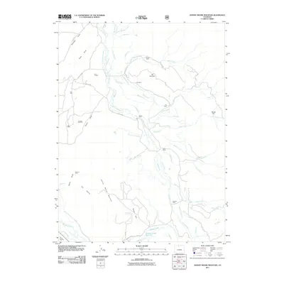
2011 Map of Johnny Moore Mountain
USGS Topo · Published 2011About this map
The Canadian River cuts through this high-country landscape, where an intricate network of irrigation ditches reflects a long history of water management for local ranching operations. Numerous family-named homesteads, including Dodge Ranch, Colter Ranch, and Dickens Ranch, are situated along the river valley and its tributaries. These ranching tracts are interspersed with mining and prospecting sites concentrated in the western draws. Excavations like the Canadian Strip Mine, Marr Mine, and Winscom Mine show the intersection of mineral extraction and traditional land use. Higher elevations are defined by prominent landmarks such as Elk Mountain and the namesake Johnny Moore Mountain, while localized natural basins like Brown Park and Muddy Park vary the terrain. The presence of features such as the Spear and Michigan Highline Ditch and Bonafide Ditch highlights the critical role of hydraulic engineering in maintaining the productivity of this Larimer County territory.
Find a feature on this map
60 named features on this map. Tap any name to fly to it.
Don’t see what you’re looking for? This feature index may not catch every label — zoom into the map to look around manually.
Map Details
Editions of this 2011 Johnny Moore Mountain Map
This is the sole edition of this map. No revisions or reprints were ever made.
Other maps of this area

1916 · Home
USGS Topo · 1:125,000

1920 · Home
USGS Topo · 1:125,000

1954 · Greeley
USGS Topo · 1:250,000

1954 · Craig
USGS Topo · 1:250,000

1955 · Eagle Hill
USGS Topo · 1:24,000

1955 · Gould
USGS Topo · 1:24,000

1955 · Owl Ridge
USGS Topo · 1:24,000

1955 · Shipman Mountain
USGS Topo · 1:24,000

1955 · Gould NW
USGS Topo · 1:24,000

1955 · Kings Canyon
USGS Topo · 1:62,500