
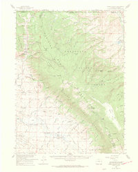
1955 Map of Kings Canyon
USGS Topo · Published 1969About this map
The high-country mining and ranching economy of northern Colorado and southern Wyoming is preserved here, centered on the high pass of Kings Canyon. This 1955 survey, compiled from 1968 data, illustrates a landscape defined by natural resource extraction and early cattle operations. Evidence of the region's mineral wealth is seen at the Village Belle Mine and Kings Canyon Mine, while the southern reaches of the map show the Battleship Oil Field near the North Sand Hills. The presence of the Dowell Homestead, The Horse Ranch, and Blevins Ranch highlights the scattered settlement patterns typical of this mountainous border territory.
Find a feature on this map
100 named features on this map. Tap any name to fly to it.
Don’t see what you’re looking for? This feature index may not catch every label — zoom into the map to look around manually.
Map Details
Editions of this 1955 Kings Canyon Map
2 editions found
Other maps of this area

1895 · Laramie
USGS Topo · 1:125,000

1902 · Laramie
USGS Topo · 1:125,000

1905 · Laramie
USGS Topo · 1:125,000

1906 · Medicine Bow
USGS Topo · 1:125,000

1906 · Laramie
USGS Topo · 1:125,000

1908 · Laramie
USGS Topo · 1:125,000

1908 · Medicine Bow
USGS Topo · 1:125,000

1916 · Home
USGS Topo · 1:125,000

1920 · Home
USGS Topo · 1:125,000

1950 · Northgate
USGS Topo · 1:24,000