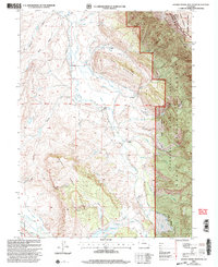
2000 Map of Johnny Moore Mountain
USGS Topo · Published 2004About this map
The rugged divide between Jackson and Larimer counties is defined by the high peaks of the Medicine Bow Mountains, where the Rawah Wilderness meets the Colorado State Forest. This landscape is shaped by a complex network of high-altitude irrigation, with the Medicine Bow-Canadian Ditch and Michigan Ditch traversing steep slopes to manage water flow toward the Canadian River.
Find a feature on this map
56 named features on this map. Tap any name to fly to it.
Don’t see what you’re looking for? This feature index may not catch every label — zoom into the map to look around manually.
Map Details
Editions of this 2000 Johnny Moore Mountain Map
This is the sole edition of this map. No revisions or reprints were ever made.
Other maps of this area

1916 · Home
USGS Topo · 1:125,000

1920 · Home
USGS Topo · 1:125,000

1954 · Greeley
USGS Topo · 1:250,000

1954 · Craig
USGS Topo · 1:250,000

1955 · Eagle Hill
USGS Topo · 1:24,000

1955 · Gould
USGS Topo · 1:24,000

1955 · Owl Ridge
USGS Topo · 1:24,000

1955 · Shipman Mountain
USGS Topo · 1:24,000

1955 · Gould NW
USGS Topo · 1:24,000

1955 · Kings Canyon
USGS Topo · 1:62,500