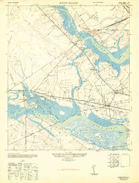
1948 Map of Johns Island
USGS Topo · Published 1948About this map
Drayton Hall and Ashley Hall anchor this coastal landscape, situated along the north bank of the Ashley River. The map captures a critical nexus of South Carolina's riverine and rail geography, where the Atlantic Coast Line, Southern, and Seaboard Air Line railroads converge near the marshes of Johns Island. This era shows a transition in land use, from the legacy of major estates to active industrial sites like Bula Mines and the development of numerous small settlements including Nosbig, Melvin, and Wappoo. Evidence of colonial-era fortifications remains visible through labels for Fort Bull and several Old Fort locations along the river bends. This survey provides a distinct look at the ecclesiastical and educational infrastructure of the period, featuring St Andrews School No 10 and several prominent houses of worship like St Peters Church.
Find a feature on this map
63 named features on this map. Tap any name to fly to it.
Don’t see what you’re looking for? This feature index may not catch every label — zoom into the map to look around manually.
Map Details
Editions of this 1948 Johns Island Map
3 editions found
Other maps of this area

1919 · Ladson
USGS Topo · 1:21,120

1919 · Johns Island
USGS Topo · 1:21,120

1919 · Wadmelaw Island
USGS Topo · 1:62,500

1919 · Melgrove
USGS Topo · 1:21,120

1919 · Charleston
USGS Topo · 1:21,120

1919 · James Island
USGS Topo · 1:21,120

1919 · Legareville
USGS Topo · 1:21,120

1920 · Ravenels
USGS Topo · 1:62,500

1940 · Melgrove
USGS Topo · 1:24,000

1943 · Legareville
USGS Topo · 1:24,000