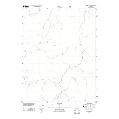
2011 Map of Johns Peak
USGS Topo · Published 2011About this map
Johns Peak and Kinneys Peak dominate this high-elevation landscape in Sevier County, defining a topography of high ridges and deep drainages. The area serves as a significant headwater region, where waters flow through complex networks like North Last Chance Creek and South Last Chance Creek. A single primary artery, Last Chance Rd, provides access through the high country, connecting remote landmarks such as Round Spring and the secluded Paradise Valley Lake. The drainage patterns, including Red Creek and Clear Creek, illustrate the natural erosion and water distribution characteristic of this part of the Utah plateau, where seasonal moisture and spring-fed features are vital to the local ecology and high-altitude rangeland management.
Find a feature on this map
10 named features on this map. Tap any name to fly to it.
Don’t see what you’re looking for? This feature index may not catch every label — zoom into the map to look around manually.
Map Details
Editions of this 2011 Johns Peak Map
This is the sole edition of this map. No revisions or reprints were ever made.
Other maps of this area

1885 · Fish Lake
USGS Topo · 1:250,000

1896 · Fish Lake
USGS Topo · 1:250,000

1922 · Emery No.3
USGS Topo · 1:31,680

1925 · Acord Lakes
USGS Topo · 1:62,500

1956 · Salina
USGS Topo · 1:250,000

1960 · Salina
USGS Topo · 1:250,000

1962 · Salina
USGS Topo · 1:250,000

1966 · Yogo Creek
USGS Topo · 1:24,000

1968 · Johns Peak
USGS Topo · 1:24,000
1968 · Old Woman Plateau
USGS Topo · 1:24,000