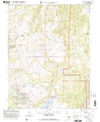
2001 Map of Johns Peak
USGS Topo · Published 2003About this map
Johns Peak serves as a prominent high point in this section of the Fishlake National Forest, where the high desert terrain transitions into steep ridges and deep drainages. The landscape is defined by its water sources, including the alpine waters of Paradise Lake and Paradise Valley Lake situated in the southern reaches. Notable for its isolated agricultural and resource development, the map shows Jim's Farm tucked into the northeast corner and evidence of industrial interest with a marked Mine and Drill Hole locations.
Find a feature on this map
41 named features on this map. Tap any name to fly to it.
Don’t see what you’re looking for? This feature index may not catch every label — zoom into the map to look around manually.
Map Details
Editions of this 2001 Johns Peak Map
This is the sole edition of this map. No revisions or reprints were ever made.
Other maps of this area

1885 · Fish Lake
USGS Topo · 1:250,000

1896 · Fish Lake
USGS Topo · 1:250,000

1922 · Emery No.3
USGS Topo · 1:31,680

1925 · Acord Lakes
USGS Topo · 1:62,500

1956 · Salina
USGS Topo · 1:250,000

1960 · Salina
USGS Topo · 1:250,000

1962 · Salina
USGS Topo · 1:250,000

1966 · Yogo Creek
USGS Topo · 1:24,000

1968 · Johns Peak
USGS Topo · 1:24,000
1968 · Old Woman Plateau
USGS Topo · 1:24,000