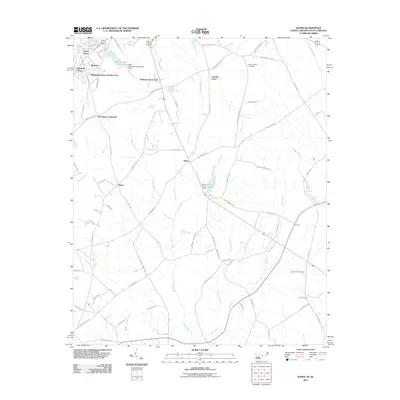
2011 Map of Johns
USGS Topo · Published 2011About this map
Stewartsville Cemetery serves as a prominent landmark in this rural landscape, situated just north of the community of Johns. The terrain is characterized by a complex network of coastal plain drainage, including Leith Creek, Bull Branch, and Shoe Heel Creek, which define the agricultural and residential layout. Small, distinct neighborhoods such as Sunny Acres, Edgeland Park, and Whispering Pines Number Two concentrate around the northwestern edge of the map, while McArthur Crossroads and Hasty remain more dispersed. The presence of Saint Andrews College Lake and its associated dam reflect local water management for recreation or institutional use. This survey illustrates the persistence of small North Carolina settlements and the importance of family-named roads like Harry Malloy Rd and Edgar Gibson Rd in providing connectivity between scattered farmsteads and rail points like Turnout.
Find a feature on this map
82 named features on this map. Tap any name to fly to it.
Don’t see what you’re looking for? This feature index may not catch every label — zoom into the map to look around manually.
Map Details
Editions of this 2011 Johns Map
This is the sole edition of this map. No revisions or reprints were ever made.
Other maps of this area

1942 · Rockingham
USGS Topo · 1:125,000

1949 · Gibson
USGS Topo · 1:24,000

1949 · Laurinburg
USGS Topo · 1:24,000

1949 · Wakulla
USGS Topo · 1:24,000

1949 · Hamlet
USGS Topo · 1:62,500

1949 · Laurinburg
USGS Topo · 1:62,500

1953 · Florence
USGS Topo · 1:250,000

1954 · Florence
USGS Topo · 1:250,000

1957 · Laurinburg
USGS Topo · 1:24,000

1971 · Minturn
USGS Topo · 1:24,000