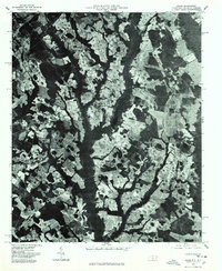
1976 Map of Johns
USGS Topo · Published 1978About this map
Laurinburg and its surrounding agricultural outskirts dominate this orthophotograph, which captures the Scotland County landscape in the mid-1970s. The aerial imagery reveals the intricate mosaic of cultivated fields and dense woodlots characteristic of this coastal plain region. Distinct small communities and local landmarks are visible along the road network, including Johns and Mc Arthur Crossroads, providing a clear look at the rural settlement patterns before significant modern expansion. The orthophoto format allows for a precise examination of land use, from the residential clusters at Hasty to the wooded corridors and farmstead layouts near Turnout. This perspective highlights the importance of the local highway system in connecting these dispersed agricultural hubs.
Find a feature on this map
5 named features on this map. Tap any name to fly to it.
Don’t see what you’re looking for? This feature index may not catch every label — zoom into the map to look around manually.
Map Details
Editions of this 1976 Johns Map
This is the sole edition of this map. No revisions or reprints were ever made.
Other maps of this area

1942 · Rockingham
USGS Topo · 1:125,000

1949 · Gibson
USGS Topo · 1:24,000

1949 · Laurinburg
USGS Topo · 1:24,000

1949 · Wakulla
USGS Topo · 1:24,000

1949 · Hamlet
USGS Topo · 1:62,500

1949 · Laurinburg
USGS Topo · 1:62,500

1953 · Florence
USGS Topo · 1:250,000

1954 · Florence
USGS Topo · 1:250,000

1957 · Laurinburg
USGS Topo · 1:24,000

1971 · Minturn
USGS Topo · 1:24,000