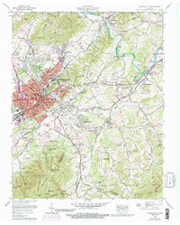
1959 Map of Johnson City
USGS Topo · Published 1991About this map
Johnson City serves as a major hub for the Southern RR and Clinchfield RR during this late-1950s period, with industrial and institutional growth extending toward the Watauga River. The landscape is defined by the sharp transition from the urban grid of downtown to the steep slopes of Buffalo Mountain and Cherokee Mountain. Significant regional landmarks include the Veterans Administration Center at Mountain Home (PO) and the campus of Milligan College to the southeast. To the east, the Sycamore Shoals Monument stands near Elizabethton, marking an area of deep historical importance. Residential expansion is evident in neighborhoods like Pine Crest and College Park, while the Watauga Steam Plant and Johnson City Airfield represent the era's infrastructure. Countless family cemeteries, such as Patton-Simmons Cem and Mottern Cem, are scattered across the surrounding ridges.
Find a feature on this map
147 named features on this map. Tap any name to fly to it.
Don’t see what you’re looking for? This feature index may not catch every label — zoom into the map to look around manually.
Map Details
Editions of this 1959 Johnson City Map
4 editions found
Other maps of this area

1891 · Roan Mountain
USGS Topo · 1:125,000

1894 · Roan Mountain
USGS Topo · 1:125,000

1904 · Roan Mountain
USGS Topo · 1:125,000

1934 · Iron Mtn Gap
USGS Topo · 1:24,000

1935 · Watauga Valley
USGS Topo · 1:48,000

1935 · Erwin
USGS Topo · 1:24,000

1935 · Spurgeon
USGS Topo · 1:24,000

1935 · Elizabethton
USGS Topo · 1:24,000
1935 · Unicoi
USGS Topo · 1:24,000
1935 · Bluff City
USGS Topo · 1:24,000