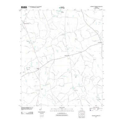
2011 Map of Johnson Corner
USGS Topo · Published 2011About this map
Johnson Corner and the surrounding agricultural lands of Toombs County appear in this 2011 survey, showing a landscape defined by small settlements and a complex network of creeks. The area is anchored by several rural communities, including Toombs Central and South Thompson, which are connected by a dense web of named county roads such as Paul Lockley Rd and S Harden Chapel Rd. This map is particularly valuable for genealogical research, as it identifies numerous family-named landmarks and resting places, including the Pittman Cemetery, Odom Cemetery, and Cobb Creek Cemetery.
Find a feature on this map
94 named features on this map. Tap any name to fly to it.
Don’t see what you’re looking for? This feature index may not catch every label — zoom into the map to look around manually.
Map Details
Editions of this 2011 Johnson Corner Map
This is the sole edition of this map. No revisions or reprints were ever made.
Other maps of this area

1953 · Waycross
USGS Topo · 1:250,000

1957 · Macon
USGS Topo · 1:250,000

1958 · Macon
USGS Topo · 1:250,000

1958 · Waycross
USGS Topo · 1:250,000

1964 · Macon
USGS Topo · 1:250,000

1970 · Johnson Corner
USGS Topo · 1:24,000

1970 · Alston
USGS Topo · 1:24,000

1970 · Vidalia
USGS Topo · 1:24,000

1970 · Ohoopee
USGS Topo · 1:24,000

1970 · Reidsville West
USGS Topo · 1:24,000