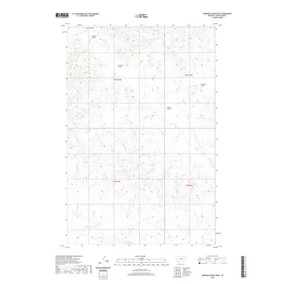
2020 Map of Johnson Coulee West
USGS Topo · Published 2020About this map
Morris Coulee and Garfield Coulee define the dissected breaks of northern McCone County in this contemporary topographic record. The landscape is dominated by a complex network of ephemeral drainages and intermittent streams, including Nelson Cr and Coal Cr, which carve through the high plains. These coulees, such as Dogtown Coulee and Crookers Coulee, reveal the natural erosion patterns characteristic of the region's semi-arid environment. The lack of concentrated settlements or major transportation arteries underscores the vast, open nature of this portion of eastern Montana, where the land is primarily partitioned by the Public Land Survey System. Researchers will find the township and range boundaries for t20n r44e and t20n r45e clearly delineated, providing an essential framework for identifying specific land parcels and historical grazing or ranching areas.
Find a feature on this map
11 named features on this map. Tap any name to fly to it.
Don’t see what you’re looking for? This feature index may not catch every label — zoom into the map to look around manually.
Map Details
Editions of this 2020 Johnson Coulee West Map
This is the sole edition of this map. No revisions or reprints were ever made.
Other maps of this area

1954 · Jordan
USGS Topo · 1:250,000

1954 · Glendive
USGS Topo · 1:250,000

1956 · Jordan
USGS Topo · 1:250,000

1957 · Glendive
USGS Topo · 1:250,000

1958 · Jordan
USGS Topo · 1:250,000

1958 · Glendive
USGS Topo · 1:250,000

1964 · Jordan
USGS Topo · 1:250,000

1973 · Rodgers Hall
USGS Topo · 1:24,000

1973 · Nelson Creek Bay
USGS Topo · 1:24,000

1978 · Fort Peck Lake East
USGS Topo · 1:100,000