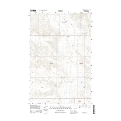
2017 Map of Johnson Dam
USGS Topo · Published 2017About this map
Johnson Dam sits at the heart of this drainage-carved landscape in Phillips County, serving as a focal point for the surrounding water systems. The terrain is defined by a series of distinct coulees, including Guston Coulee and Moss Coulee, which channel runoff into the larger creek networks. Significant water bodies like Beaver Cr, Sevenmile Cr, and Cottonwood Cr wind through the township and range divisions, illustrating the vital role of seasonal and permanent water management in the northern plains. Local access is maintained through rural routes such as Harb Rd and Beaver Creek Rd, which traverse the undulating topography. This survey captures a moment of managed prairie hydrology, where family-named and descriptive landmarks like Windmill Coulee and Pickhandle Coulee reflect the ranching and livestock heritage of this Montana interior.
Find a feature on this map
15 named features on this map. Tap any name to fly to it.
Don’t see what you’re looking for? This feature index may not catch every label — zoom into the map to look around manually.
Map Details
Editions of this 2017 Johnson Dam Map
This is the sole edition of this map. No revisions or reprints were ever made.
Other maps of this area

1905 · Bowdoin
USGS Topo · 1:62,500

1954 · Glasgow
USGS Topo · 1:250,000

1957 · Glasgow
USGS Topo · 1:250,000

1958 · Glasgow
USGS Topo · 1:250,000

1984 · Clanton Coulee
USGS Topo · 1:24,000

1984 · Pinks
USGS Topo · 1:24,000

1984 · Harb
USGS Topo · 1:24,000
1984 · Harb SW
USGS Topo · 1:24,000
1984 · Horse Pasture Coulee
USGS Topo · 1:24,000
1984 · Content NW
USGS Topo · 1:24,000