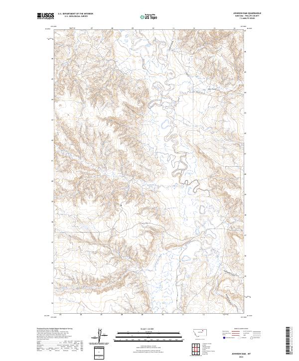
2024 Map of Johnson Dam
USGS Topo · Published 2024About this map
Beaver Creek meanders through this section of Phillips County, defining a drainage system marked by numerous coulees and seasonal waterways. The landscape is characterized by the intricate erosion patterns of Guston Coulee, Moss Coulee, and Pickhandle Coulee, which draw toward the main creek bed. Human presence is marked by the intersecting lines of Harb Rd and Beaver Creek Rd, following the natural contours of the drainage basin. This area represents a classic example of high-plains topography, where tributaries like Sevenmile Creek and Cottonwood Creek have carved deep into the terrain over millennia. The Public Land Survey System grid lines for t28n r32e and surrounding townships provide a formal structure over this complex network of draws and ridges.
Find a feature on this map
14 named features on this map. Tap any name to fly to it.
Don’t see what you’re looking for? This feature index may not catch every label — zoom into the map to look around manually.
Map Details
Editions of this 2024 Johnson Dam Map
This is the sole edition of this map. No revisions or reprints were ever made.
Other maps of this area

1905 · Bowdoin
USGS Topo · 1:62,500

1954 · Glasgow
USGS Topo · 1:250,000

1957 · Glasgow
USGS Topo · 1:250,000

1958 · Glasgow
USGS Topo · 1:250,000

1984 · Clanton Coulee
USGS Topo · 1:24,000

1984 · Pinks
USGS Topo · 1:24,000

1984 · Harb
USGS Topo · 1:24,000
1984 · Harb SW
USGS Topo · 1:24,000
1984 · Horse Pasture Coulee
USGS Topo · 1:24,000
1984 · Content NW
USGS Topo · 1:24,000