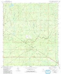
1954 Map of Johnson Hammock
USGS Topo · Published 1993About this map
The winding Econfina River defines the drainage of this Taylor County landscape, flowing through a low-lying terrain of wetlands and hammocks. Established as a revision of a mid-1950s survey, the area reflects a sparsely settled part of the Florida panhandle where water governs the geography. The presence of Oakland Ch serves as a lone community landmark amidst a network of small watercourses like Rose Creek and Regular Creek.
Find a feature on this map
8 named features on this map. Tap any name to fly to it.
Don’t see what you’re looking for? This feature index may not catch every label — zoom into the map to look around manually.
Map Details
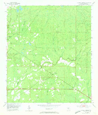
Editions of this 1954 Johnson Hammock Map
3 editions found
Other maps of this area

1952 · Secotan
USGS Topo · 1:24,000

1954 · Johnson Hammock
USGS Topo · 1:24,000

1954 · Hampton Springs
USGS Topo · 1:24,000

1954 · Secotan
USGS Topo · 1:24,000

1954 · Valdosta
USGS Topo · 1:250,000

1955 · Snipe Island
USGS Topo · 1:24,000

1955 · Shady Grove
USGS Topo · 1:24,000

1955 · Nutall Rise
USGS Topo · 1:24,000

1955 · Lamont SE
USGS Topo · 1:24,000

1955 · Manlin Hammock
USGS Topo · 1:24,000