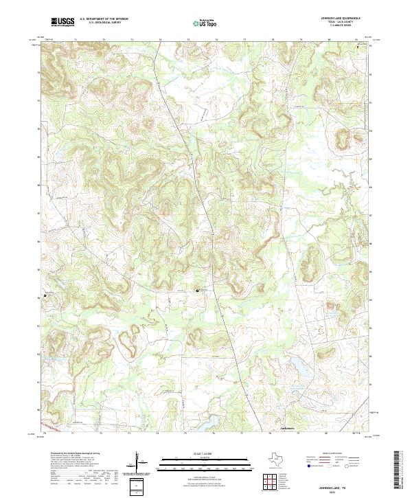
2022 Map of Johnson Lake
USGS Topo · Published 2022About this map
The W Fork Trinity River winds through this section of Jack County, carving a drainage system that includes Jones Cr, Flag Springs Cr, and the branching forks of Big Cleveland Cr. The landscape is defined by the intersection of water management and rural settlement, with significant reservoirs like Worthington Lake Number 3 and Soil Conservation Service Site 21 Reservoir dotting the terrain. For those tracing family histories, several burial grounds are preserved across the area, including Brown Cem in the northeast and Patton Cem near the center. The road network, comprising routes like Old Post Oak Rd and Graves Cemetary Rd, connects these remote sites to the northern outskirts of Jacksboro. The map also illustrates the transition between larger water bodies like Prunty Lake and the smaller seasonal flows of Pusley Br.
Find a feature on this map
36 named features on this map. Tap any name to fly to it.
Don’t see what you’re looking for? This feature index may not catch every label — zoom into the map to look around manually.
Map Details
Editions of this 2022 Johnson Lake Map
This is the sole edition of this map. No revisions or reprints were ever made.
Other maps of this area

1954 · Wichita Falls
USGS Topo · 1:250,000

1958 · Wichita Falls
USGS Topo · 1:250,000

1960 · Jacksboro
USGS Topo · 1:24,000

1961 · Jacksboro NE
USGS Topo · 1:24,000

1962 · Antelope Creek NE
USGS Topo · 1:24,000

1964 · Senate
USGS Topo · 1:24,000

1964 · Cundiff
USGS Topo · 1:24,000

1964 · Johnson Lake
USGS Topo · 1:24,000

1964 · Lynn Creek
USGS Topo · 1:24,000
1964 · Newport
USGS Topo · 1:24,000