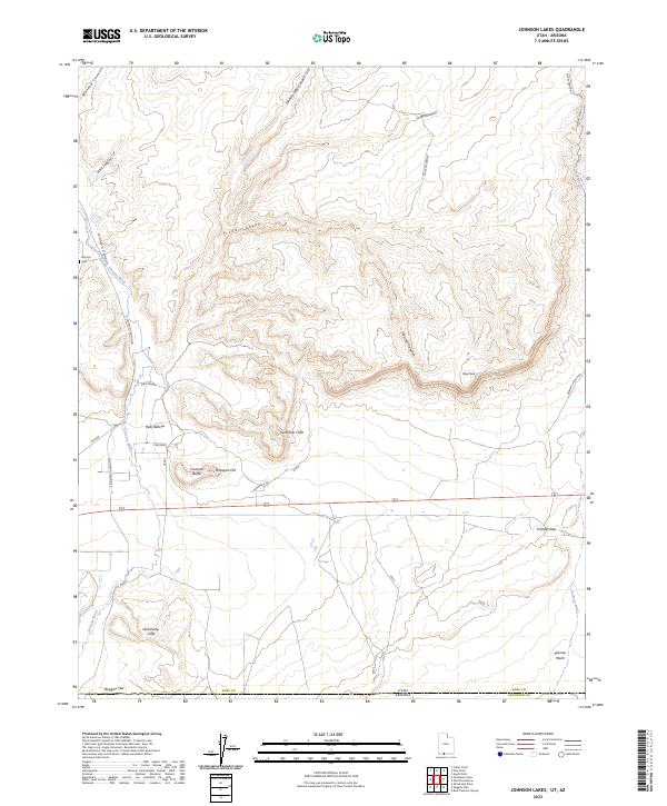
2023 Map of Johnson Lakes
USGS Topo · Published 2023About this map
Noel Ranch sits at the base of the dramatic escarpment where the Vermilion Cliffs and Shinarump Cliffs define the high desert topography of Kane County. This 2023 survey details the complex drainage systems of the Grand Staircase-Escalante National Monument, including the carved paths of Johnson Wash and Johnson Lakes Canyon. The map preserves local historical markers such as the Johnson Cem and distinctive landforms like Crescent Butte, Dishopan Hill, and the evocative Hells Bellows.
Find a feature on this map
30 named features on this map. Tap any name to fly to it.
Don’t see what you’re looking for? This feature index may not catch every label — zoom into the map to look around manually.
Map Details
Editions of this 2023 Johnson Lakes Map
This is the sole edition of this map. No revisions or reprints were ever made.
Other maps of this area

1886 · Kanab
USGS Topo · 1:250,000

1886 · Kaibab
USGS Topo · 1:250,000

1953 · Cedar City
USGS Topo · 1:250,000

1953 · Grand Canyon
USGS Topo · 1:250,000

1954 · Buckskin Gulch NW
USGS Topo · 1:24,000

1954 · Buckskin Gulch SW
USGS Topo · 1:24,000

1954 · Johnson SE
USGS Topo · 1:24,000

1954 · Johnson NE
USGS Topo · 1:24,000

1954 · Shinarump NW
USGS Topo · 1:24,000

1954 · Johnson SW
USGS Topo · 1:24,000