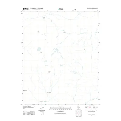
2012 Map of Johnson Peak
USGS Topo · Published 2012About this map
Mount Anna Mills and Johnson Peak overlook a high alpine landscape defined by expansive meadows and seasonal camp sites. This 2012 record documents the upper reaches of the S Fork Kern River watershed, where the drainage network of Golden Trout Cr and Johnson Cr carved a complex series of plateaus and valleys. The presence of Little Whitney Cow Camp and Tunnel Air Camp indicates the area's continued use for remote backcountry operations and grazing management within the Sierra Nevada.
Find a feature on this map
21 named features on this map. Tap any name to fly to it.
Don’t see what you’re looking for? This feature index may not catch every label — zoom into the map to look around manually.
Map Details
Editions of this 2012 Johnson Peak Map
This is the sole edition of this map. No revisions or reprints were ever made.
Other maps of this area

1905 · Olancha
USGS Topo · 1:125,000

1907 · Olancha
USGS Topo · 1:125,000

1907 · Mt. Whitney
USGS Topo · 1:125,000

1919 · Mt. Whitney
USGS Topo · 1:125,000

1937 · Mt. Whitney
USGS Topo · 1:125,000

1948 · Fresno
USGS Topo · 1:250,000

1955 · Fresno
USGS Topo · 1:250,000

1956 · Fresno
USGS Topo · 1:250,000

1956 · Mount Whitney
USGS Topo · 1:62,500

1956 · Olancha
USGS Topo · 1:62,500