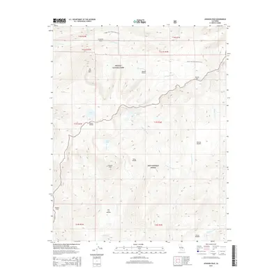
2015 Map of Johnson Peak
USGS Topo · Published 2015About this map
Johnson Peak stands as a central landmark in this high-altitude landscape of the Sierra Nevada, where the boundaries of Sequoia National Park and Inyo National Forest meet. The geography is defined by glacial features and alpine hydrologies, including the Rocky Basin Lakes, Johnson Lake, and Funston Lake on the Boreal Plateau. The presence of the Pacific Crest National Scenic Trail winding through Siberian Pass and past the Siberian Outpost highlights the importance of traditional backcountry transit routes in this protected wilderness. Waterways like Golden Trout Cr and the S Fork Kern River drain the high meadows, including Whitney Meadow and Salt Lick Meadow, illustrating the intricate drainage patterns of the southern High Sierra. The naming of Mt Anna Mills and Forgotten Canyon suggests the early influence of explorers and surveyors who charted these crests.
Find a feature on this map
32 named features on this map. Tap any name to fly to it.
Don’t see what you’re looking for? This feature index may not catch every label — zoom into the map to look around manually.
Map Details
Editions of this 2015 Johnson Peak Map
This is the sole edition of this map. No revisions or reprints were ever made.
Other maps of this area

1905 · Olancha
USGS Topo · 1:125,000

1907 · Olancha
USGS Topo · 1:125,000

1907 · Mt. Whitney
USGS Topo · 1:125,000

1919 · Mt. Whitney
USGS Topo · 1:125,000

1937 · Mt. Whitney
USGS Topo · 1:125,000

1948 · Fresno
USGS Topo · 1:250,000

1955 · Fresno
USGS Topo · 1:250,000

1956 · Fresno
USGS Topo · 1:250,000

1956 · Mount Whitney
USGS Topo · 1:62,500

1956 · Olancha
USGS Topo · 1:62,500