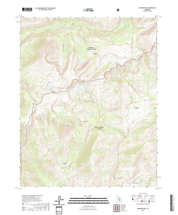
2021 Map of Johnson Peak
USGS Topo · Published 2021About this map
Johnson Peak and the high elevations of the Sierra Nevada dominate this landscape, where the boundary between Sequoia National Park and Inyo National Forest marks a transition between protected wilderness zones. The terrain is defined by glacial features and high-altitude basins, including the Siberian Outpost and the Boreal Plateau. A network of historic footpaths and pack trails, such as the Pacific Crest National Scenic Trl and the Siberian Pass Trl, connect the remote waters of Johnson Lake and Funston Lake with expansive grazing areas like Whitney Meadow. Along the southern reaches, the Kern Wild and Scenic River corridor provides a vital drainage for the region, fed by named seasonal flows including Golden Trout Creek and Johnson Cr.
Find a feature on this map
47 named features on this map. Tap any name to fly to it.
Don’t see what you’re looking for? This feature index may not catch every label — zoom into the map to look around manually.
Map Details
Editions of this 2021 Johnson Peak Map
This is the sole edition of this map. No revisions or reprints were ever made.
Other maps of this area

1905 · Olancha
USGS Topo · 1:125,000

1907 · Olancha
USGS Topo · 1:125,000

1907 · Mt. Whitney
USGS Topo · 1:125,000

1919 · Mt. Whitney
USGS Topo · 1:125,000

1937 · Mt. Whitney
USGS Topo · 1:125,000

1948 · Fresno
USGS Topo · 1:250,000

1955 · Fresno
USGS Topo · 1:250,000

1956 · Fresno
USGS Topo · 1:250,000

1956 · Mount Whitney
USGS Topo · 1:62,500

1956 · Olancha
USGS Topo · 1:62,500