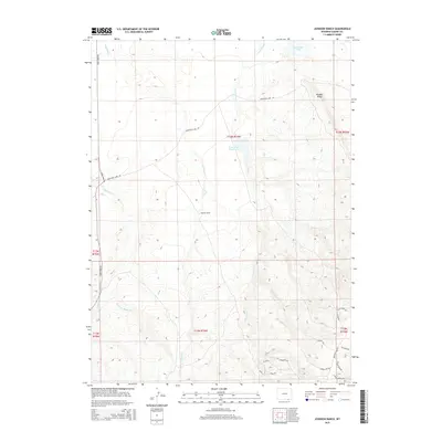
2015 Map of Johnson Ranch
USGS Topo · Published 2015About this map
Johnson Ranch sits at the center of this high-elevation Wyoming landscape, where numerous seasonal drainages carve through the plains and foothills of Boulder Ridge. The hydrology of this area in Albany County is defined by a network of creeks including Antelope Cr, Lone Tree Cr, and Running Water Cr, which feed into local catchments like Sportsman Lake and the Lone Tree Reservoir. This map illustrates the transition from open range to the more complex topography of the ridge in the southeast, where the land is scored by draws and small canyons. A detailed network of rural roads such as Sportsman Lake Rd and Sand Creek Rd provides access to these remote ranchlands, while newer named tracks like Smokin Saw Rd and Elk Ridge Rd reflect the enduring nature of the local ranching and recreational economy.
Find a feature on this map
30 named features on this map. Tap any name to fly to it.
Don’t see what you’re looking for? This feature index may not catch every label — zoom into the map to look around manually.
Map Details
Editions of this 2015 Johnson Ranch Map
This is the sole edition of this map. No revisions or reprints were ever made.
Other maps of this area

1895 · Laramie
USGS Topo · 1:125,000

1902 · Laramie
USGS Topo · 1:125,000

1905 · Laramie
USGS Topo · 1:125,000

1906 · Laramie
USGS Topo · 1:125,000

1908 · Laramie
USGS Topo · 1:125,000

1916 · Home
USGS Topo · 1:125,000

1920 · Home
USGS Topo · 1:125,000

1954 · Cheyenne
USGS Topo · 1:250,000

1954 · Greeley
USGS Topo · 1:250,000

1957 · Greeley
USGS Topo · 1:250,000